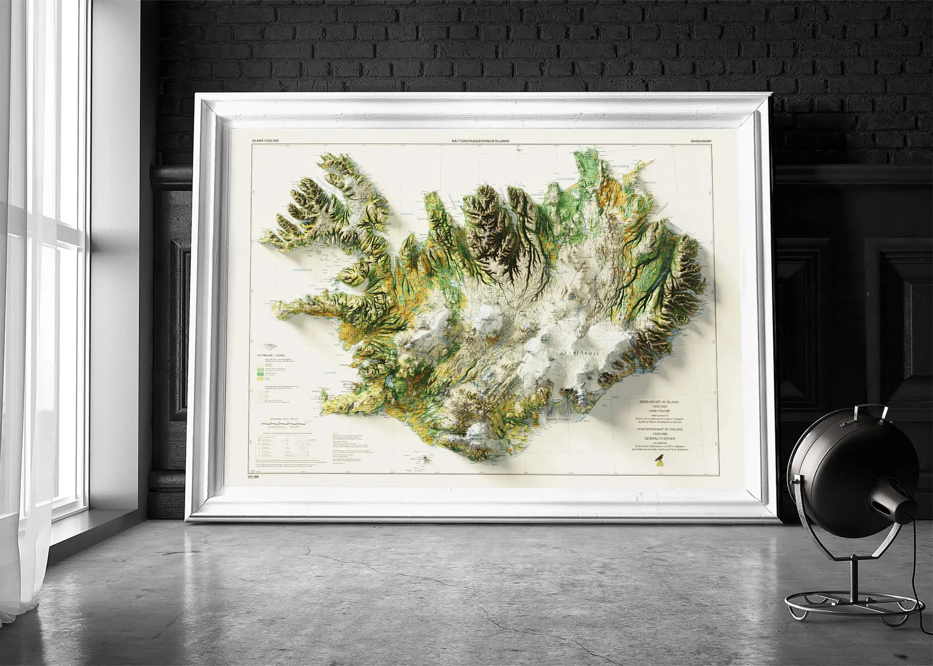
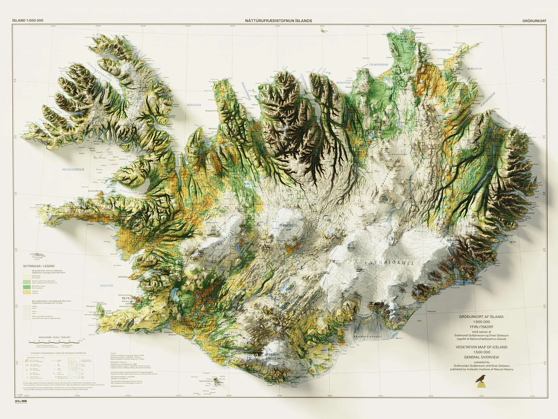
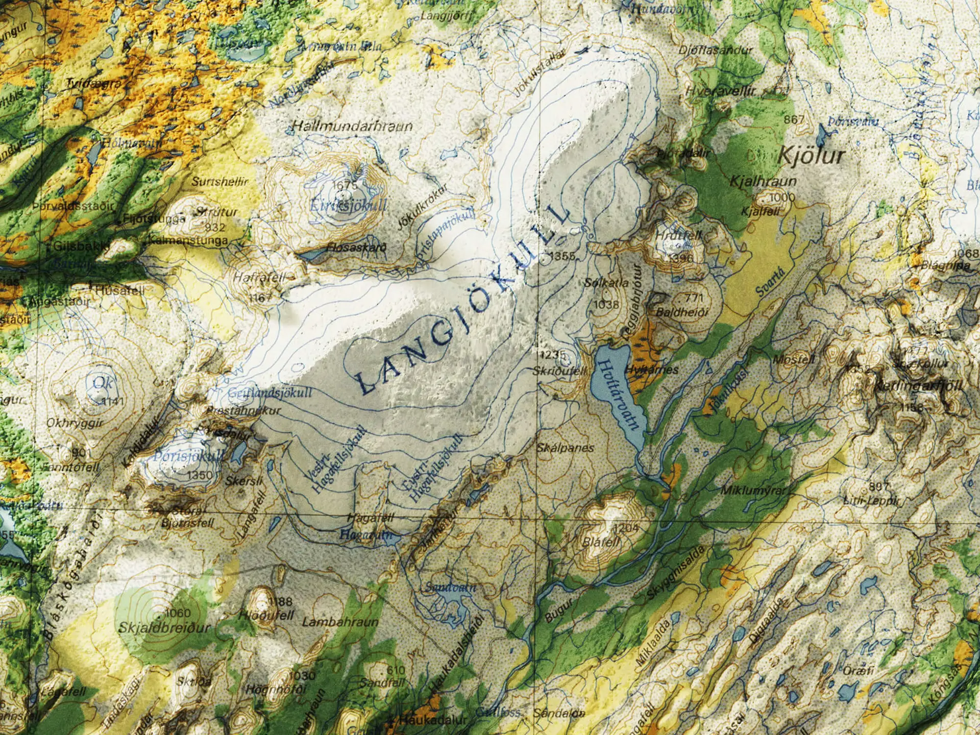
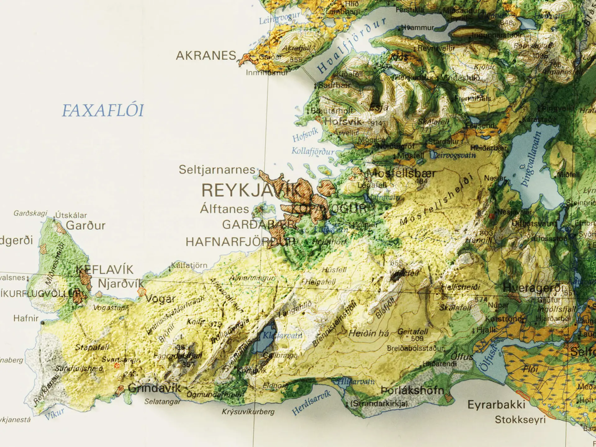
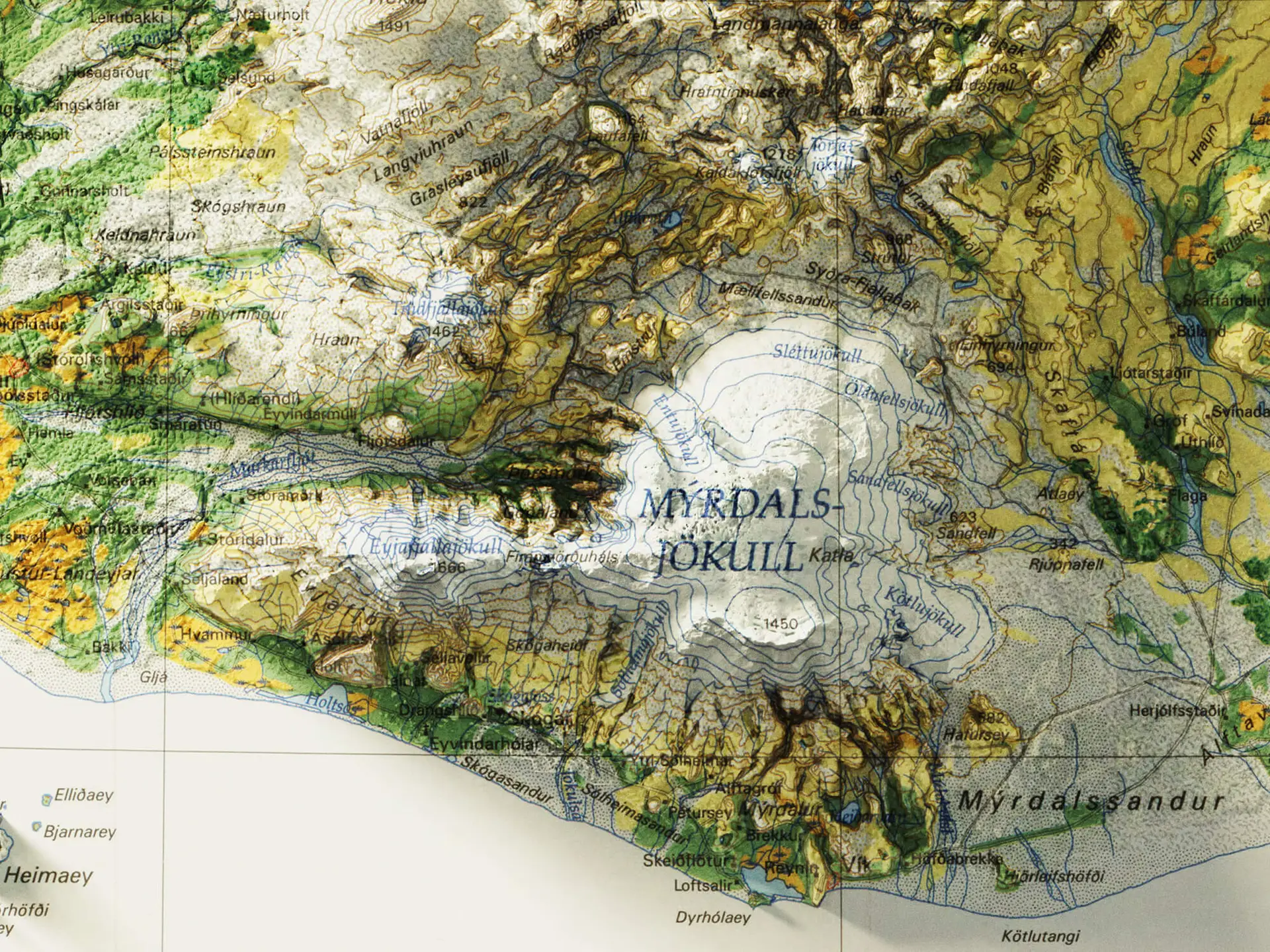
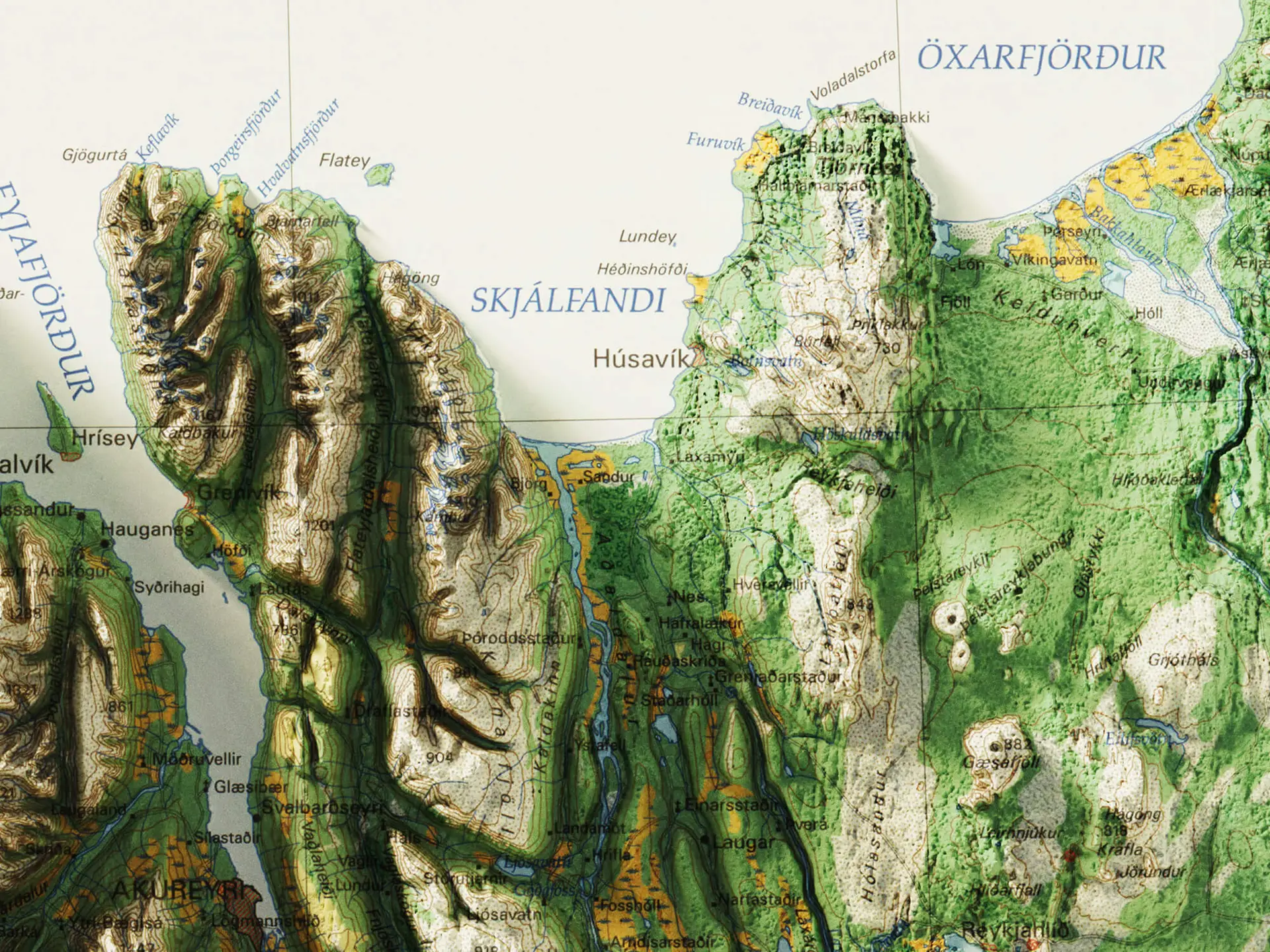
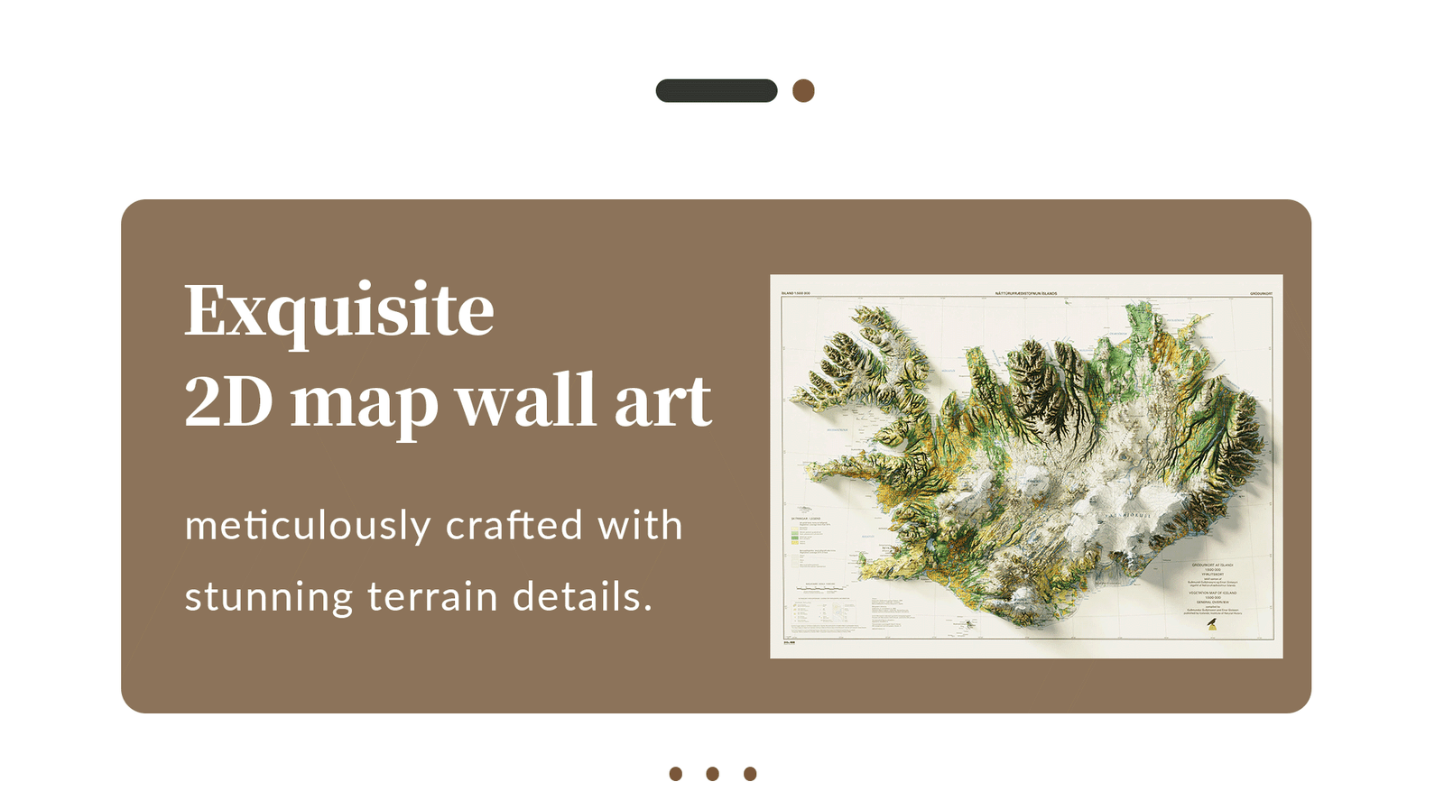
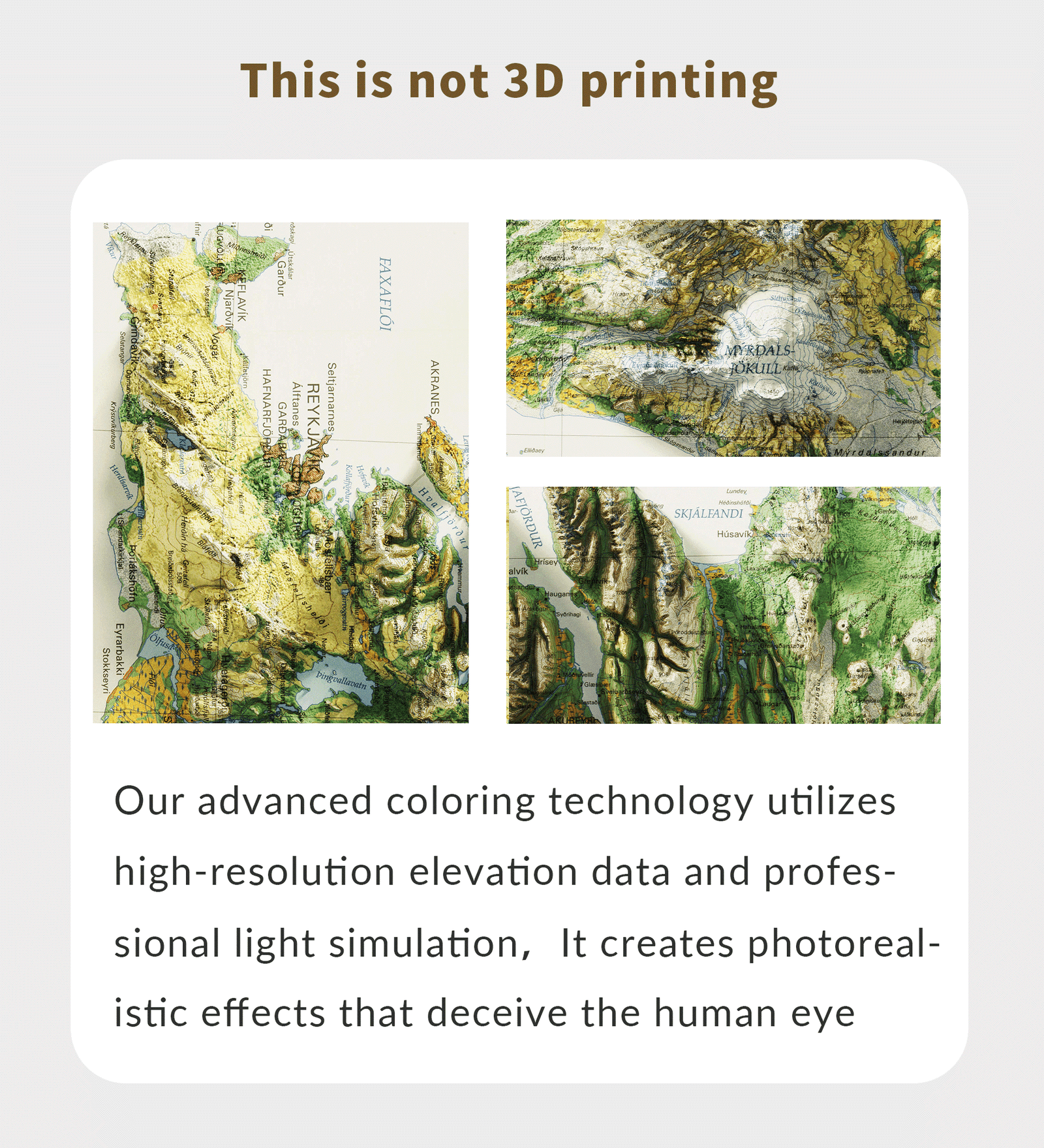
Experience the power of nature beneath your fingertips with the 2D Geological Map of Iceland — a stunning representation of one of the world’s most geologically active regions. This map highlights Iceland’s volcanic zones, rift valleys, mid-Atlantic ridge, and geothermal fields in vivid color and scientific accuracy.
Perfect for Earth science education, volcanology students, and lovers of Icelandic nature, this map combines striking visual design with up-to-date geological data. From the Reykjanes Peninsula to the Askja volcanic system, explore the living geology of Iceland where two tectonic plates meet.
Features:
-
Clear labeling of volcanic systems and rift zones
-
Shows active faults, geothermal regions, and plate boundaries
-
Based on data from Icelandic Meteorological Office and international geology sources
-
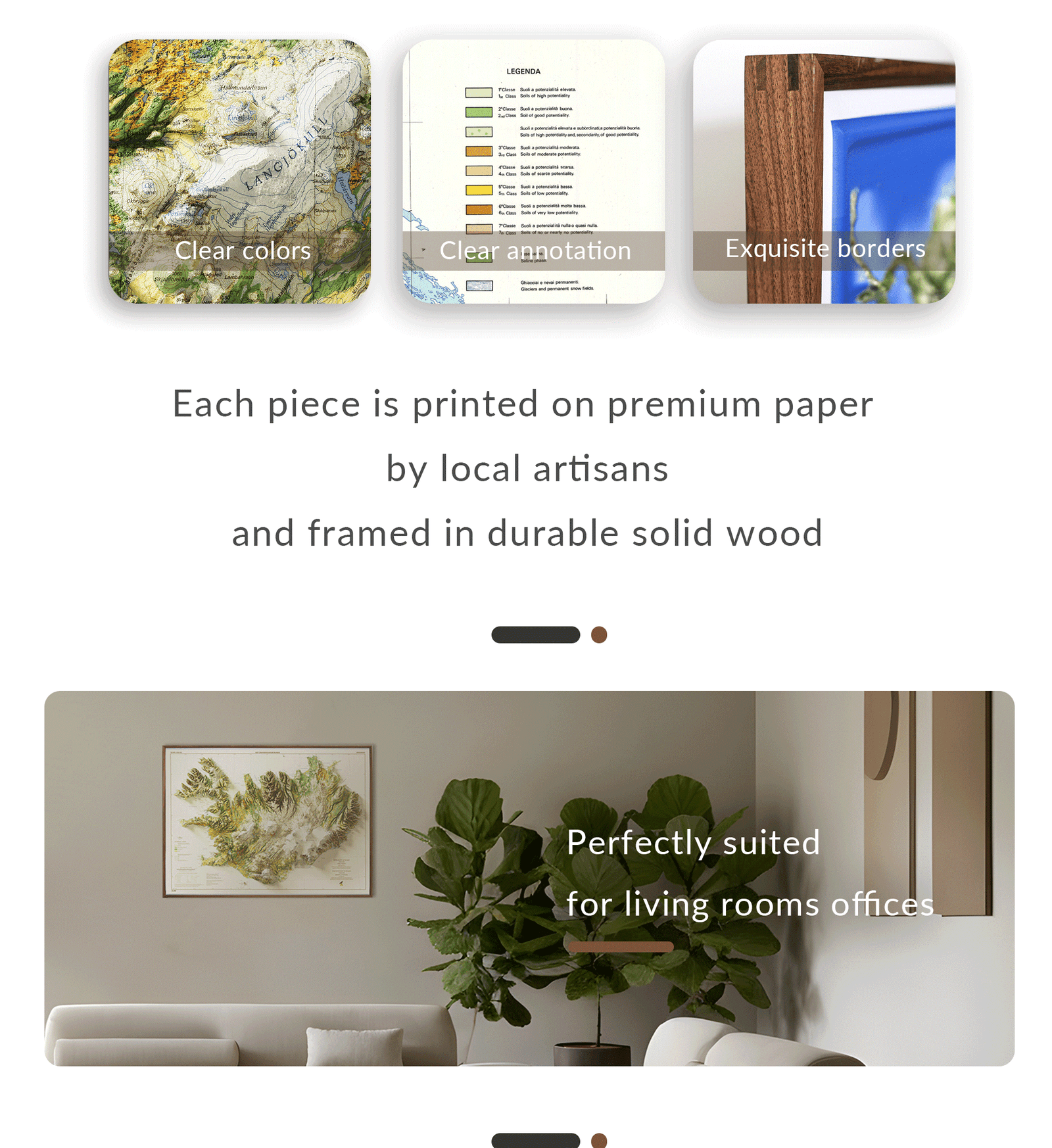
Great for display in classrooms, labs, offices, or living spaces
🎁 Perfect For:
-
Science and geography teachers
-
Volcano lovers and travelers
-
Iceland enthusiasts and explorers
-
Unique and educational wall décor
Bring Iceland’s geological wonder to your wall — where volcanoes, tectonics, and glaciers collide.


Reviews
There are no reviews yet.